M.P. Water and Land Management Institute
(WALMI), Bhopal
(A premiere autonomous training institute, working as a part of Panchayat and the Rural Development Department, Govt. of M.P.)
Fundamental of GIS Technology and its Applications using Free and Open Source Software
Duration: Fifteen Days Mode: Online Course Expert: Dr. R.K.Jaiswal Course Fee: Rs. 4000 /-
Bank Name : Punjab National Bank
Account : 6476000100025346
IFSC Code : PUNB0647600
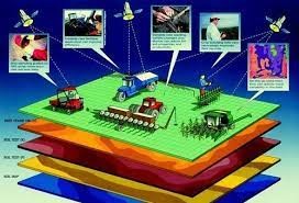
In the modern era of technology, geographic information systems (GIS) and remote sensing (RS) play an important role in diverse fields.
1. Learning Objectives:
An advanced information system like GIS plays a vital role and serves as a complete platform in every phase of the infrastructure life cycle. Advancement and availability of technology have set new marks for professionals in the infrastructure development areas. Now more and more professionals are seeking the help of these technologically smart and improved information systems like GIS for infrastructure development. Every phase of the infrastructure life-cycle is greatly affected and enhanced by the enrollment of GIS.
Remote sensing is the art and science of making measurements of the earth using sensors on airplanes or satellites. These sensors collect data in the form of images and provide specialized capabilities for manipulating, analyzing, and visualizing those images. The remote sensing data provide temporal, and spatial information with human interference for large areas and can be coupled in GIS has the added advantage of collecting meaningful information and taking appropriate results.

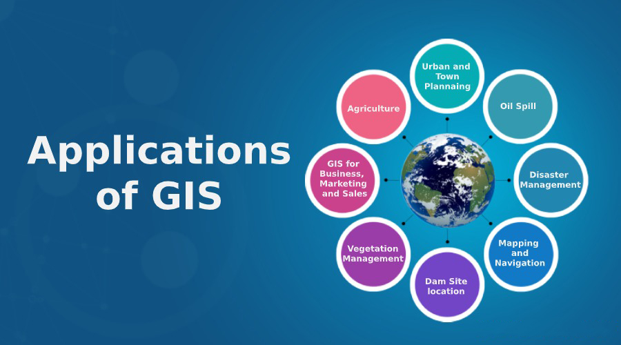
GIS in Conjunction with RS has enormous applications in different fields.Some of the analyses that can be performed by GIS are:
Planning
In planning its major contribution is to give us an organized set of data that can help professionals to combat complex scenarios relating to the selection of site, environmental impact, the study of the ecosystem, managing risk regarding the use of natural resources, sustainability issues, managing traffic congestion, routing of roads and pipelines, etc.
Data Collection
Precise and accurate data is the core driving factor of any successful project. GIS is equipped with almost all those tools and functions that enable the user to have access to the required data within a reasonable time.
Analysis:
Analysis is one of the major and most influential phases of the infrastructure life cycle. Analysis guides us about the validity or correctness of design or we can say that analysis is a method that supports our design.
Construction:
It is the stage when all layout plans and paperwork designs come into existence in the real world. The GIS helps the professionals to understand the site conditions that affect the schedule baseline and cost baseline. To keep the construction within budget and schedule GIS guides us on how to utilize resources on-site efficiently by:
Operations:
Operations are controlled by modeling site data and compared to the baselines prepared in the planning phase. Modeling of the site may be in the form of raster images or CAD drawings. These can help us to keep track of timely operations of activities.
GIS can help to make a record of work that has been completed and can give us visualization in the form of thematic maps which will guide us about the rate of operations, completed operations, and pending operations.In short, we can say that GIS will prove to be the foundation of next-generation civil engineering.
2. Course Content: -
3. Pedagogy: -
In the modern era of technology, remote sensing (RS) and geographic information systems (GIS) play an important role in diverse fields including water resources, geography, geology, environment, urban planning, hydrology, ecology, forest management, etc. In the course will learn the basics of geographic information systems, GIS software available, download of QGIS and its installation, geographic projection system, import of hard sheets and toposheets, georeferencing of external sheets, digitization and preparation of layout maps. In the course, participants will learn about various freely available data available online for various applications. Remote sensing data provide important input due to their synoptic viewing of large areas at regular intervals and this course will give insight into remote sensing principles, data source and type of data, and their possible application in land use classification. The course is designed in such a way that every lecture will be followed by practical sessions and tutorials for great learning of these techniques. It is expected that participants have a laptop or computer with them to carry out tutorials. The faculties for the course will be scientists from the National Institute of Hydrology, Bhopal and Roorkee, National Remote Sensing Centre, Hyderabad, professors from Maulana Azad National Institute of Technology, Indira Gandhi Krishi Vishvidalaya Raipur, and Engineers/Professional working with Multi-National Companies. The course lectures will be organized in the evening session online so working officers, students, and professionals can join the course without disturbing their daily routine. At the end of the session, a test will be conducted and a certificate will be awarded after successfully passing the test and attending more than 90% of classes, and submitting tutorials on time.
4. Learning Outcomes: -
The course is designed to provide basic knowledge of GIS and remote sensing for working professionals in the water resource departments, public health engineering, forest, rural development, urban development, etc. The course will be useful to the students of graduapostgraduateuate, and Ph.D. level students in civil engineering, geology, geography, urban planning, architecture, environmental, and other allied streams. At the end of the course, the participants will be able to know the basics of RS & GIS, map making, georeferencing, digitization, map layout, and map preparation. The course will also give great insight into the open-source software for GIS and open data availability, download, and application. The course is designed with more emphasis on practicals and tutorials and will be done online in the evening, so participants can carry out this course after regular office or classes.
5. Targeted Participants:
The training program is designed for the development of professionals working in the field of water conservation and management. This course is for everyone. This course is for everyone interested to learn geospatial techniques.
The following can attend this course:
6. Eligibility Criteria: -
The participant should have a reasonably good understanding of computers and software.
7. Course Duration: -
The course is designed for two weeks
8. Course Fee: -
The course is designed for a group of 20 participants. Course 4000 Rupees per participant.
Course Expert
Mr. Sharad deep
Mr. Sharaddeep is an experienced GIS/Geospatial professional with an excellent academic profile as he has completed his Master’s in Geoinformatics. Currently, he is working as Senior Consultant with Hexagon Safety & Infrastructure and working for Smart Cities and Public Safety domain for the company. He has more than 10 years of experience in the field of GIS/Geospatial and Public Safety Technology. He has comprehensive knowledge and understanding of spatial data analysis & management. He has a long range of working experience in GIS domain projects for multiple departments of Madhya Pradesh.
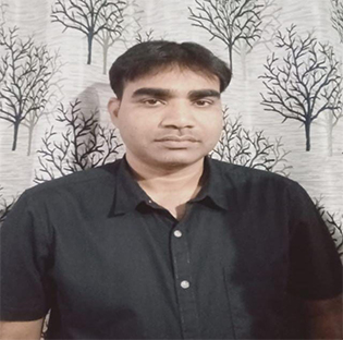
Mr. Sukant
Mr. Sukant is a civil engineer with nearly a decade of work experience and a specialist background in hydrology and geo-spatial analysis. Sukant has worked as a researcher, a consultant, a mentor, and an engineer for leading organisations, specialized in the field of hydrological modelling, remote sensing, and geographic information systems (GIS), drought mapping, advance surveying techniques, hydrological parameter retrieval using geo-spatial analysis, application of python in water resources management. Sukant is the author and co-author of number of publications in peer reviewed international/national journals and conferences in the areas of climate change impact assessment, development of cloud-based and desktop-based models/tools, soil erosion analysis, open-source techniques and datasets, hydrological modelling, land use dynamics, etc.


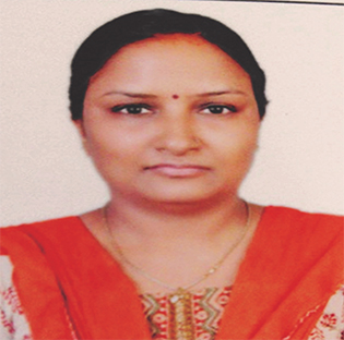
Dr. Rubeena Khan
Dr. Rubeena Khan is a Hydrogeologist specialized in Geospatial Technology having 10 years of experience in the same field. Currently she is working as Senior GIS Consultant in Rajiv Gandhi Mission for Watershed Development Vindhyachal Bhavan Bhopal. She has done her Ph.D. in Hydrogeology with Remote Sensing and GIS from Barkatullah University. 2016. She has worked on various projects like Dam Break Analysis 2D Modeling by HEC RAS, Emergency Action Plan , Watershed Development, Groundwater Trend Analysis for state and Central Government (NIH). She is also the guest faculty of GIS for premier training Institutes like WALMI, NARONHA Academy, CRISP Bhopal. She has got a vast experience of trainings , Research, Academics in GIS. She has also won fellowship of Training Young scientist for six months in 32nd M. P. Young scientist Congress.
Dr. Swati Jain
Dr. Swati Jain experience of 20 years working in the Remote Sensing and GIS based water sector. Being a hydrogeologist I have the required knowlege on issues related to water and field exposure. I have conducted various trainings on varied topics like water quality, NRDWP guidelines, Hydrogeological Survey, Geophysical Survey of the PHE Department and other allied fields, hence the requisite skills on the same. I have had the opportunity to liaison, advocate for strategic reforms with the government in these areas. GIS and RS have been increasingly used for Forest, Landuse/ Landcover, water resources, water harvesting, and climate change monitoring. GIS is a robust tool because of its ability to process and analyze huge volumes of data from various sources. Water resources planning and management using RS is necessary to meet the demands of an increasing population. Therefore, the research of water resources based on RS images has become popular during the last decades. My present assignment requires regular visits to the field so I have also had sufficient field exposure to assess field realities and the extent to which the benefits have reached the people who need it the most.
Dr. Suresh Goswami
Dr. Suresh Goswami is well versatile in Remote Sensing and GIS and has a post-graduate and doctoral degree in the same field. While perusing his PhD from from Maulana Azad National Institute of Technology (MANIT) Dr Goswami worked on crop yield modeling and developed his understanding in remote sensing of Agriculture. During his job as Project Scientist “C” at National Centre for Medium Range Weather Forecasting (NCMRWF), Ministry of earth science, Govt of India he was engaged in modeling of changing water cycle and climate project. Overall Dr Goswami have more 12 years’ experience with more than 15 papers at International and Nation levels. He Served in many well recognized institutions and completed national level importance projects. He has handled vast range of Remote sensing and GIS Software such as ArcGIS, ERDAS as well as open source software like QGIS, SWAT, etc
9. Tentative timetable for training on “Fundamental of GIS Technology and its Applications using Free and Open Source Software”
| Day | Class time | Evening/morning | 2 hrs | course content |
|---|---|---|---|
| Day 1 | Lecture | Introduction and orientation | |
| Day 1 | Lecture | Basics of GIS, GPS & Remote Sensing & its application | |
| Day 2 | Lecture | Data acquisition from BHUVAN & Google earth/td> | |
| Day 2 | tutorial | Data acquisition from BHUVAN & Google earth | |
| Day 3 | Home Assignment | Data Acquisition Practise | |
| Day 4 | Lecture | Geo-referencing of SOI Toposheets & Remote sensing data | |
| Day 4 | Lecture | Geo-referencing of SOI Toposheets & Remote sensing data | |
| Day 4 | Lecture | Geo-referencing of SOI Toposheets & Remote sensing data | |
| Day 5 | Lecture | Geo-referencing of SOI Toposheets & Remote sensing data | |
| Day 6 | Lecture | Digitization Styling & preparation of layout (Clip & Mosaic) | |
| Day 6 | Tutorial | Digitization Styling & preparation of layout (Clip & Mosaic) | |
| Day 7 | Holiday | ||
| Day 8 | Home Assignment | Digitization Styling & preparation of layout (Clip & Mosaic) | |
| Day 9 | Lecture | Query Analysis & other GIS Operation | |
| Day 9 | Tutorial | Query Analysis & other GIS Operation | |
| Day 10 | Home Assignment | Query Analysis & other GIS Operation | |
| Day 11 | Lecture | Land Use and Land Cover | |
| Day 11 | Tutorial | Land Use and Land Cover | |
| Day 12 | Home Assignment | Land Use and Land Cover | |
| Day 13 | Lecture | Extraction of Drainage water bodies/ selection of suitable water bodies | |
| Day 13 | Extraction of Drainage water bodies/ selection of suitable water bodies | ||
| Day 13 | Tutorial | Extraction of Drainage water bodies/ selection of suitable water bodies | Day 14 | Holiday |
| Day 15 | Home Assignment | Extraction of Drainage water bodies/ selection of suitable water bodies | |
| Day 16 | Tutorial | Creating and Designing Maps (Tutorials) | |
| Day 16 | Tutorial | Creating and Designing Maps (Tutorials) | |
| Day 17 | Assessment | Assessment Test &Valedictory | |
-
Latest Publication
-
